Sunday, June 19, 2011

Ronald W. Caspers Wilderness Park

Ronald W. Caspers Wilderness Park


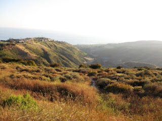
East Ridge Trail Caspers Wilderness Park

Caspers Wilderness Park is an 8,000 acre protected wilderness preserve nestled among the river terraces and sandstone canyons of the western coastal Santa Ana Mountains. The park's many fertile valleys are overtly complemented by specimen groves of native Coastal Live Oak and magnificent stands of California Sycamore. These areas are further accentuated by seasonal wildflower displays and running streams. Wildlife is abundant and can be readily viewed from any of the parks numerous trails.

I did a quick 4+/- mile loop at Caspers.  Started on Bell Canyon Trail and hiked to Sunrise Trail to East Ridge Trail to Quail Run Trail to finish the loop at Bell Canyon Trail.  This was a nice hike with some steep elevation changes.  I saw a rattle snake on East Ridge trail.  There are many beautiful cactus blooms.  Beautiful scenery and not far to drive.


Caspers Wilderness Park
33401 Ortega Hwy.( P. O. Box 395)
San Juan Capistrano, CA 92675
(949)923-2210 or (949)923-2207

Map- http://www.ocparks.com/uploadgraphics/CaspersMap1004.pdf

Site- http://www.ocparks.com/caspers/default.asp?Show=Introduction

Saturday, June 11, 2011

The Ozark Trail in Missouri

The Ozark Trail in Missouri
Ozark Trail Trail Marker

This has been a difficult review and a long time in the making.  I have been going to sections of the Ozark Trail for years.  The Ozark Trail (OT) is the preeminent destination for hiking, horseback riding, mountain biking, and primitive camping in Missouri.  It is intended to reach from St. Louis to Arkansas. Over 350 miles (563 km) of the trail have been completed as of 2008, and the estimated length when finished will be at least 500 miles (805 km). When joined to the Ozark Highlands Trail in Arkansas, the full hiking distance from end to end will be at least 700 miles (1,127 km), not including a large loop through the St. Francois Mountains in Missouri.
I haven’t hiked the entire Ozark Trail but I have been to a lot of it.  The OT bypasses many of Missouri’s finest outdoors locations along its meandering path South/Northward.  The Northern most point of the OT begins at Onondaga Cave State Park in Leasburg, MO.  The Onondaga Cave is right next to the confluence of the Meramec, Courtois, and Huzzah rivers.  I’ve done a lot of canoeing on these rivers and they are perfect for a hike/camp/canoe trip!  The cave is also a must see.

Onondaga Trail Head:
Traveling south from Onondaga cave you will pass the Huzzah conservation area, we saw a lot of Turkey’s in this area.  Continue on and you will be walking on a moderately difficult trail that follows old fire roads and ridgeline trails and will continue to hike up and down the hills intersecting the rivers at several points and even having to cross a shallow section to continue.  This beautiful area has campgrounds, floaters, caves, and a plethora of flora and fauna to enjoy.  I stopped at Bass resort and picked up my canoe that was left there the day before and canoed Huzzah, Courtois, and Meramec rivers back to my car at Onondaga Park. 
Skipping a section of trail from Bass resort to Berryman loop that I haven’t done we will continue at the Berryman Loop section of the OT.  This section is, I’m sure very lovely, and I regret not having seen it yet. It looks like this section could be done in a day. 


Berryman Loop:
The Berryman hiking trail in central Missouri traverses 24 miles through a variety of scenic Ozark countryside. It winds through timbered stands of oak, pine and bottomland hardwoods - climbing switchback fashion, from low bottoms to high cherty ridges. Interesting flora and fauna abound in the old fields, glade-like rock outcroppings and deep forest. Trail users are insured a measure of solitude and quiet, as motor vehicles are prohibited on the trail. Mountain bikes are permitted on the trail. The trail starts at Berryman Campground, the site of a Civilian Conservation Corps Camp of the same name from 1937 till the onset of World War II. The camp was jointly operated by the U.S. Army and the Forest Service and had a resident force of 300 men. Several old barracks foundations and an old well are the only remnants of the camp itself but many roads and pine plantations in the area are enduring reminders of the good works done by these men. 

Skipping a large southward section of the OT, which I haven’t yet been to, from Berryman Loop to the North side of Council Bluff Lake.

Council Bluff Lake:
This beautiful man-made lake is on the site of a town that used to exist before the dam was built.  A trail runs the perimeter of the lake and adds some miles to the OT.  There is a sand beach and campground on one side of the lake.  Good fishing and beautiful scenery this area is a jewel of central Missouri surrounded by Mark Twain National Forest and near Viburnum, MO.  The largest lake in the Mark Twain National Forest serves anglers, campers, picnickers, hikers, bicyclists and swimmers.  Fish year round in this 440 acre lake stocked with large mouth bass, redear sunfish, bluegill, crappie and catfish.  Picnic or swim at the 54,000 sq. foot sand beach.  At Chapel Hill Beach there is a concession stand, changing rooms, flush toilet, water fountains and showers.  There is also a small play area near the beach.  Additionally, there are canoes and paddle boats available for rent when the beach is open.  Council Bluff Trail is a 12-mile loop along the lake shore providing hiking and mountain biking opportunities.  The Trace Creek section of the Ozark Trail is located just west of the recreation area.  Waterfowl hunting is permitted on the lake and there are upland game opportunities as well.  24.5 miles From Hwy 21 and 221 - Go west on Hwy 32, turn left at MO-C, turn left at MO-JJ, then slight right at Council Bluff Rd/CR-635.  If beginning on Highway 49 in Reynolds County, turn right on Hwy 32, then left at MO-DD, take right on MO-C, then right at MO-JJ to Council Bluff Rd.

Just south of Council Bluff Lake the OT splits and one side runs southwest and the other southeast.  The Southeastern side (St. Francis Mountain range) is my favorite section of the OT, there you will find Taum Sauk Mountain State Park, Mina Sauk Falls, Devils Toll Gate, Johnson Shut ins, Goggins Mountain, Bell Mountain, and many other wonderful sites.

Bell Mountain to Taum Sauk Mountain:
There are several sections of this trail that are difficult.  Elevation changes and feral hogs await you.  I spent months exploring this region of Missouri and still haven’t seen as much as I would like.  Bell Mountain Wilderness Trail, is concurrent with a section of the Ozark Trail for about one mile, then splits and turns northward to the summit of Bell Mountain peak.  Joe’s creek cuts deeply into the west slope of Bell Mountain; clefts and boulders form the basic landscape. The area is rugged and suitable for experienced hikers only.  Be prepared with adequate supplies and water.  A separate two-mile trail begins on the east and leads to the top of Lindsey Mountain.
The 33-mile Taum Sauk section of the Ozark Trail is considered by the Ozark Trail Association to be one of the finest trails in Missouri.
Polished granite plaque at Missouri high point Taum Sauk reading "HIGHEST ELEVATION 1772.68 MSL VERIFIED MARCH 23, 1991 MISSOURI: MISSOURI ASSOCIATION OF REGISTERED LAND SURVEYORS"  Check out the lookout tower while on Taum Sauk.
Mina Sauk Falls, the highest waterfall in Missouri, is on Taum Sauk and can be visited by hiking a rugged trail that makes a 3-mile (4.8 km) loop from the highpoint parking area. These falls normally have water cascading over them only during times of wet weather. At other times they are reduced to a trickle or less.
Johnson Shut ins, what can I say to describe this beautiful wonder?  Johnson Shut ins has it’s unique features due to black river running into a hard rock called rhyolite.  The river washed away other rocks and transformed the area into a natural water park.  Slides, deep pools, and rhyolite outcrops make this a popular tourist destination.  This one you really must see to understand.  I would spend every day of summer here if possible.
Tower Taum Sauk Mountain

Bell Mountain

Mina Sauk Falls
Johnson Shut ins
Johnson Shut ins
Johnson Shut ins


Bell Mountain:
The wilderness area now has a total of 9,027 acres (36.53 km2). Bell Mountain is located within the Potosi-Fredericktown Ranger District of the Mark Twain National Forest, south of Potosi, Missouri in the United States. The wilderness lies in the Saint Francois Mountains and it was named after its highest point, Bell Mountain (elevation: 1,702). The Bell Mountain Wilderness is one of eight wilderness areas protected and preserved in Missouri. The area is popular for hiking as there are 12 miles (19 km) of trail, including a section of the Ozark Trail.
Bell Mountain Wilderness is part of a large parks-and-wilderness area which includes Johnson's Shut-Ins State Park, Taum Sauk Mountain State Park, and several conservation areas.
Skipping a very large section of the OT.

Bell Mountain


Powder Mill Trailhead:
I checked out a small section of the OT while canoeing the current river.  The OT intersects Current River near this trailhead and is worth a look.

Peck Ranch:
The refuge (fenced portion) of the Area is temporarily closed due to the elk reintroduction project
This area is predominantly forest with nearly 1,500 acres in glades, along with old fields, savanna, cropland and some wetlands. Facilities/features: primitive camping, picnic areas, firearms range, viewing deck, two deer/turkey blinds, one intermittent stream and four Natural Areas (Grassy Pond, Goldenseal, Stegall Mountain and Mule Hollow).

Wappapello Lake:
Recent damage to T hwy may limit access to some sections of the OT as it goes through Wappapello region.
Lake Wappapello is a reservoir on the St. Francis River, formed by Wappapello Dam Created in 1941, this 45,000-acre lake is located 120 miles south of St. Louis, Missouri. Its primary purpose is flood control though it has evolved into a recreational area with ample opportunities to boat, fish, swim or camp. The fish population of the lake include white and largemouth bass, crappie, and bluegill. The reservoir lies overwhelmingly in Wayne County, but its southernmost reaches (near the dam) extend into northern Butler County. Lake Wappapello State Park lies on the southwestern side of the lake.


http://www.ozarktrail.com/courtois.php -Section before and after Berryman Loop

Thank you,
Chris Clark

Thursday, June 9, 2011

Bryce Canyon National Park

Bryce Canyon in Utah


Bryce canyon is located in Southwestern Utah.  It has some very unique geological formations.  Bryce is distinctive due to geological structures called hoodoos, formed by wind, water, and ice erosion of the river and lake bed sedimentary rocks.  The rim at Bryce varies from 8,000 to 9,000 ft.  Bryce Canyon was not formed from erosion initiated from a central stream, meaning it technically is not a canyon. Instead headward erosion has excavated large amphitheater-shaped features.  This erosion exposed delicate and colorful pinnacles called hoodoos that are up to 200 feet high.

I hiked down into the canyon and back out using a combination of the following trails.  Also, the views from sunrise and sunset point are amazing at sunrise.  Take a look at some of the pics to get an idea. 
Rim Trail (0-11 mi/0-17.7 km round trip) Outstanding views of hoodoos from above. Trail is paved and fairly level between Sunset and Sunrise Points.

Queens Garden (1.8 mi/2.9 km round trip) This is the least difficult trail into the canyon. Using your imagination you may even see Queen Victoria at the end of a short spur trail
Navajo Trail (1.3 mi/2.2 km round trip) Navajo Trail is open only on the Wall Street side (Thors Hammer/Two Bridges side is closed due to rockfall and trail damage). The trail begins at Sunset Point and goes down into Bryce Amphitheater through a "slot" canyon where large Douglas-fir trees are stretching to reach sunlight high above.
I also did a trip to Arches National park which is not too far from Bryce canyon.  Both can be seen in 2-3 days but more time would be needed for a complete survey.


Thank you,
Chris Clark
http://johngalt4u2.blogspot.com/

Sunday, June 5, 2011

Aliso and Wood Canyon Wilderness Park


Aliso and Wood Canyon Wilderness Park
I have compiled a list of the best information available for the trails that I took on my most recent hike at Aliso and Wood Canyon Park.  I started at Top of the World and hiked along west ridge trail to rock it trail to coyote run trail to nature loop to wood canyon trail to dripping cave to Mathis trail and return to top of the world on west ridge trail.  This was a 7-7.5 mile loop.  Perhaps the best feature this park has to offer is the ability to customize your hike.  There are so many connecting trails that you make a loop any distance you want with a minimum of ground covered twice.  The cons of this park are rattlesnakes and heavy mountain bike use.  Dogs are only allowed on some parts of the hike.  West ridge trail allows dogs on a leash.  Beautiful scenery abounds; rolling hills, ocean views, interesting geological formations, flora, and fauna included.  This is the closest to nature I have found in over populated Southern California.  Check out the links at the bottom for detailed information and maps.  All of the trails that I went on are moderate to difficult.  Happy hiking!
Wood Canyon Trail: Wood Canyon Trail serves as the backbone to the 30-mile trail
system, providing access points and opportunities for loop trail excursions. The
varied vegetation along its length on the canyon floor, easy access to multiple
geological and biological interpretive sites, and fairly level grade allow for enjoyment
by a diverse group of recreationists. The Cave Rock and Dripping Cave Trails stem
from the trail in lower Wood Canyon with the historic Old Corral site past the
connection with Mathis Canyon Trail.
Dripping Cave Trail: A distance from the Wood Canyon Trail, Dripping Cave is a
popular natural interest point in the park. From the Dripping Cave, the trail leads
northwest, crossing the western ridge of Wood Canyon before dropping down to the
grassland at the floor of Mathis Canyon. Dripping Cave Trail connects with Mathis
Canyon Trail at its base.

Mathis Canyon Trail: At its start at Wood Canyon Trail, Mathis Canyon Trail begins
a gentle grade into Mathis Canyon through grassland with scattered elderberry
shrubs, sycamores and oak trees. At its junction with Oak Grove Trail the trail begins
a challenging ascent up Mathis Canyon. Ascending the trail offers panoramic views
of Wood Canyon, Moulton Peak, and the Rock-it Trail snaking down the ridge to the
north. Mathis Canyon Trail terminates at West Ridge Trail at an elevation of
approximately 700 feet.
Coyote Run Trail: Coyote Run Trail parallels Wood Creek on the west side and
connects the Wood Creek hiking trail and the popular Wood Canyon multi-use trail.
This trail provides a more scenic and varied alternative to the Wood Canyon Trail
because it skirts the lower portion of Wood Canyon’s west ridge rather than following
the canyon floor. At its northern end, just past the Old Sycamore Grove, the trail
crosses Wood Creek and connects with Wood Canyon Trail.
Rock-It Trail: The Rock-It Trail is a highly technical trail that is popular with mountain
cyclists. Named for its passage over sandstone rock outcroppings that begin about a
third of the way down, the trail originates from the top of Wood Canyon at the West
Ridge Trail. A popular loop opportunity commonly utilized by cyclists entering at the
main entrance includes a ride north up the Wood Canyon and Cholla Trails, a short
ride along the West Ridge Trail, and the steep downhill thrill provided by Rock-It.
Rock-It allows for access from the City of Laguna Beach via the Alta Laguna
Community Park and the Top of the World trailhead from West Ridge Trail. Rock-It
joins with Coyote Run Trail near the base of Wood Canyon.
West Ridge Trail: The West Ridge Trail is a graded fire road that provides access
from the Alta Laguna Community Park (City of Laguna Beach) and the Top of the
World area. Beginning at an elevation of approximately 1000 feet, the trail traverses
the ridge between Wood Canyon and Laguna Canyon. The trail continues north and
connects first with Mathis Canyon Trail, then Rock-it Trail at the water tank on El
Toro Ridge, followed by Stairstep Trail, and finally Lynx and Cholla Trails. Numerous unauthorized trails drop down to Laguna Canyon Road from the West Ridge Trail.
West Ridge Trail terminates at the Cholla Trail in upper Wood Canyon.
Nature Loop Trail: The Nature Loop Trail connects Wood Canyon and Coyote Run
Trail to provide a 0.5 mile “hikers only” loop around the west ridge of Wood Canyon
and the east ridge of Mathis Canyon. At its juncture with Coyote Run Trail, the
habitat transitions from coastal sage scrub to lush oak woodland and riparian
vegetation. Coyote Run Trail parallels Wood Creek and returns the hiker back to the
beginning of the Nature Loop just off of Wood Canyon Trail.
Destinations:
Dripping Cave. Dripping Cave is a popular natural interest point in the park. The sandstone
overhang tucked into the narrow canyon was once used by 19th Century stagecoach and
livestock thieves as a hide-out. Visitors can climb into the 15 x 40 foot cave for a closer
inspection, viewing the holes in the wall that were once fitted with pegs to hold supplies or
the blackened ceiling that is mistakenly thought to have been created by campfires.
Moisture dripping from the ledges sustains the ferns and other plants that frame the opening
of the cave.
Top of the World (TOW). The TOW vista point, at an elevation of approximately 1,050 feet,
places the park within a regional context with its breathtaking views of the Pacific Ocean and
Catalina Island, AWCWP sprawling to the east, and the San Gabriel and San Bernardino
Mountains beyond. TOW is accessed by the West Ridge Trail at Alta Laguna Park.


Thank you,
Chris Clark